Site Tools
User Tools
This is an old revision of the document!
Table of Contents
Generalities
What is ToolMap?
ToolMap is a cost-free, open-source software dedicated for digitizing data and producing complex multi-layer GIS projects.
It was developped in response to the need of easily creating projects with:
- A faultless and accurate topological structure.
- A correct and homogenized semantic attribution.
It was developped in response to the two most reccurent problems given by such maps:
- The topological structure
- The semantical meaning
How does it work?
ToolMap perform its duty based on two basic and undissociable principles:
- The data model describing the nature and spatial relationships between the possible different features.
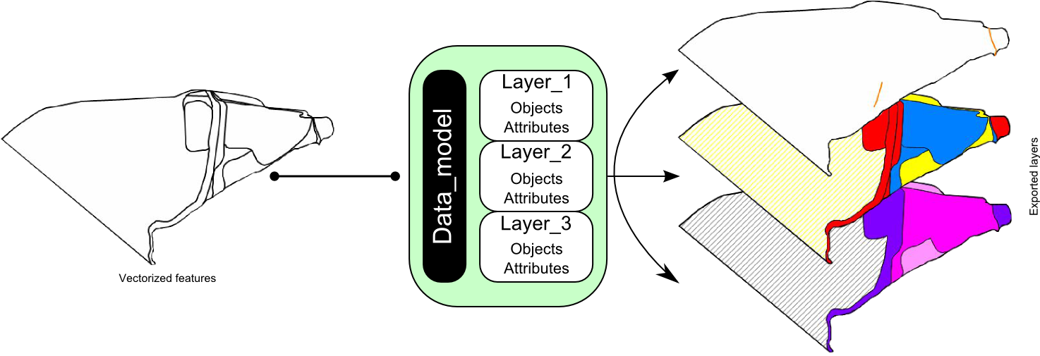
- The digitizing process allowing only two types of geometries, lines and points to represent all two-dimensional “real-world” objects. No polygon layer exists in ToolMap; they are built from the combination of lines delinaeting surfaces. Digitizing all lines, line feature (strictly speaking) and borders of polygons within one single layer yields the following advantages:
- No redundancy in the digitzing process: geometric shapes referring to multiple object types are digitized and stored only once.
- Perfect match between geometric shapes occurring in different thematic GIS layers: all objects are extracted from the same construction layers.
ToolMap rely on two different but undissociable aspects:
- The vectorization process
- The data model
The method ToolMap uses for the digitizing process deny the redundancy of geometries. The one referring to multiple layers are digitized only once and distributed through the different layers with the help of the data model. In addition to the method ToolMap provides strong tools for the vectorization as well as for the validation process.