
HyFORS
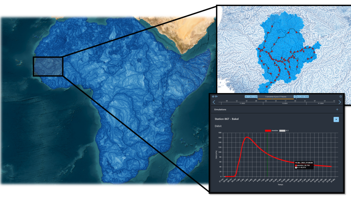
Hydrological Forecasting Online with Routing System HyFORS is a cloud platform that makes the adoption of operational hydrological/hydraulic forecasting systems accessible anywhere in the world with limited resources. By using global weather datasets and automating the creation and deployment of a complex operational system on Google Cloud Platform, this solution will help reduce hydrological risks and better manage water resources. A plug-and-play cloud platform for global flood forecasting In its 2022 Global… Read More
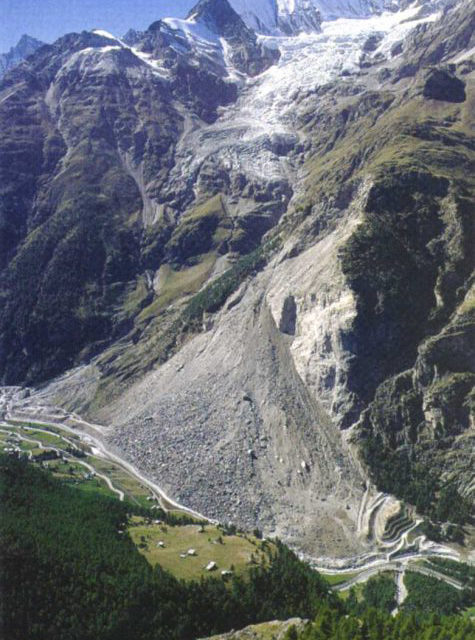
Debris flow warning system (SALT)
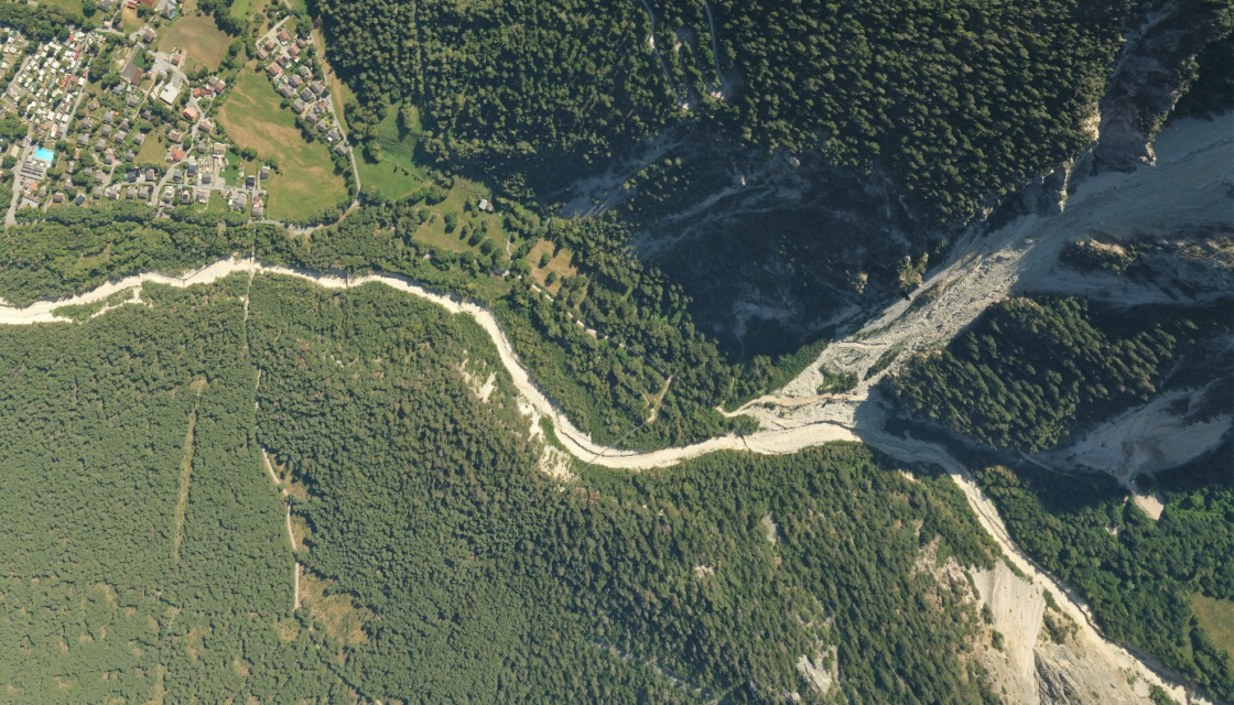
Real-time operational warning system for debris flow forecasting in Valais The aim of the Système d’Alerte de Laves Torrentielles (SALT) project is to set up a meteorological warning system for selected sites throughout the canton of Valais. These areas have been affected by numerous debris flow events in the past, which is why a real-time warning system project has been initiated to prevent such events in the future. This system enables SMS… Read More
GUARDAVAL monitoring system
The Canton of Valais natural hazard monitoring portal Guardaval is a comprehensive IT platform for operational and synoptic monitoring of natural hazards (ground instabilities, floods, glacial hazards, meteorological hazards, debris flows, etc.) in the Valais. For over 20 years, CREALP has been maintaining and developing this constantly evolving platform for the State of Valais, integrating more data and functionalities every day. Today, Guardaval integrates more than 70 data sources from different suppliers… Read More
Geocadastre | geological surveys
Le cadastre cantonal des sondages géologiques – a web portal for consulting and editing subsoil data for the Canton of Valais Launched at the end of 2013, Géocadastre – the cantonal geological survey cadastre – has gradually established itself as a reference tool for practitioners. The Geocadast web portal not only enables consultation of subsurface data, but also provides information on the cantonal cadastre. The quaternary data contained in the Geocadastre are… Read More
Exceptional and extreme floods (CRUEX ++)
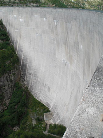
A methodology for estimating exceptional and extreme floods in Switzerland The CRUEX++ “Exceptional and Extreme Floods” research project follows on from the CRUEX project, which in 2001 proposed a preliminary methodology of the PMP-PMF (Probable Maximum Precipitation-Probable Maximum Flood) type: a methodology for estimating extreme floods capable of integrating the hydrological particularities of the Alpine environment. As the quantitative estimation of extreme floods is still a poorly understood issue, this new project… Read More
RS MINERVE software
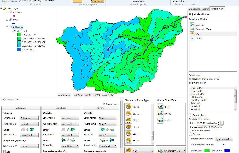
Modeling hydrological and hydraulic networks using a semi-distributed approach PRESENTATION RS MINERVE is a hydrological and hydraulic modeling software package that simulates rainfall-runoff transformations and free-surface flows. The software is capable of representing not only the main hydrological processes such as snowmelt, glacial melt and surface and subsurface flows, but also regulated structures such as reservoirs, gates, spillways, water intakes, turbines or pumps, and other hydraulic structures. Comprehensive analysis of a hydrological-hydraulic… Read More
Spatial Reference Information System | Geological Hazards
A Spatially Referenced Information System for managing geological hazards in the canton of Valais SIRS-DAGEO is one of the spatially referenced information systems (SIRS) set up by the canton of Valais to optimize the use and development of information contained in natural hazard studies (avalanches, floods, ground instabilities). SIRS-DAGEO records information relating to geological hazards. Launched by the canton of Valais in 2004, SIRS-DAGEO enables data from geological hazard studies to be… Read More