HyFORS
Hydrological Forecasting Online with Routing System
HyFORS is a cloud platform that makes the adoption of operational hydrological/hydraulic forecasting systems accessible anywhere in the world with limited resources. By using global weather datasets and automating the creation and deployment of a complex operational system on Google Cloud Platform, this solution will help reduce hydrological risks and better manage water resources.

Architecture and components of the HyFORS platform. The system is hosted on Google servers (GCP).
A plug-and-play cloud platform for global flood forecasting
In its 2022 Global Risks Report, the World Economic Forum identified water-related risks as among the most significant in terms of impact, and these are set to intensify in the future due to climate change, population growth and economic activities.
To this end, although a myriad of high-resolution spatio-temporal meteorological datasets with global coverage are now available online, their potential remains under-exploited due to their large volume and growing complexity. Recent advances in computing, data assimilation methods and cloud computing now enable these massive datasets to be processed in real time, opening up new possibilities for providing reliable and timely environmental information for decision-making.

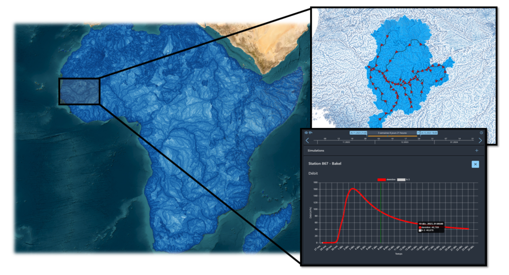
Figure 2: Illustration of a watershed in Mali and its hydrographic network modeled in real-time by HyFORS.
Facilitate the adoption of operational systems with limited resources
HyFORS enables hydrological and hydraulic simulations to be carried out on a widely accessible online platform, using the simulation tools developed by CREALP. The proposed platform is able to draw on global and local hydrometeorological data to automatically calculate operational hydrological models anywhere in the world, in order to better manage water resources, optimize energy production and reduce flood risks and associated damage. It is an integrated solution for companies interested in flow forecasting and with limited resources (access to data, computing resources and programming skills). The platform combines (i) the integration of global and regional datasets and hydrological models adapted to local conditions, (ii) a user-friendly interactive web interface with visualization of results for a wide audience, and (iii) real-time forecasts.

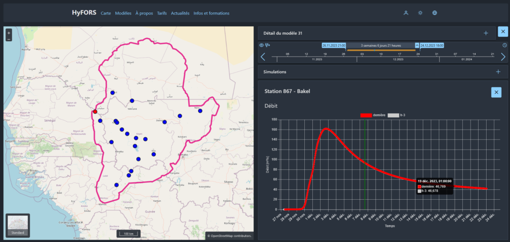
Figure 3: Illustration of the online interface showing the extent of the calculation domain (left) with its control points, and the results in graphical form with time navigation (right).

