
Hydrometric network monitoring
8 - Hydrogeological modeling
Hazard monitoring
Natural hazard management
Raising awareness of water-related issues
Solutions for hydro-meteorological monitoring
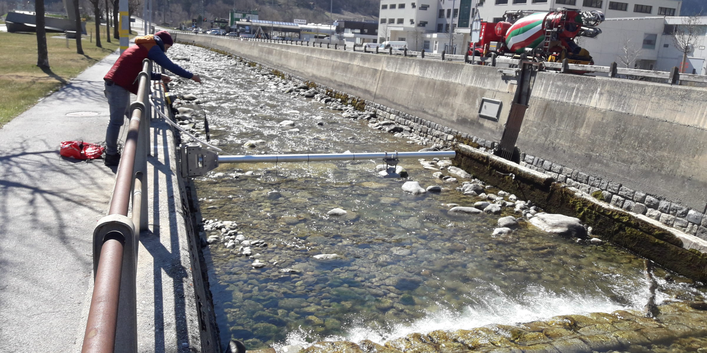
Hydrometric network of the Canton of Valais
Hydrometric monitoring of lateral watercourses on a cantonal scale has two main objectives:
- Provide a level and/or flow monitoring and alarm system for communal alarm and intervention plans (PAI).
- To provide basic data (water levels and flows) for river management, the sizing of facilities and the improvement of the MINERVE system dedicated to flood forecasting and management.
The hydrometric network, commissioned at the end of 2015, comprises some twenty stations. It is managed and maintained by CREALP with technical collaboration from the“Maintenance Logistics” section of the Mobility Service(SDM).
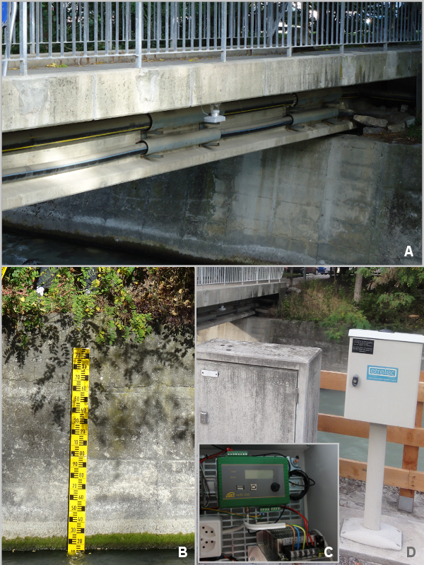
A. Radar sensor installed under the bridge
B. Limnimetric scale
C. Datalogger recording measurements
D. Technical cabinet