
Charriage + seismic sensors

SismoRiv project: Development of a charriage measurement system based on low-cost seismic sensors The aim of this project, which is dedicated to the issue of sediment transport, is to develop a measurement method that is simple to install and use, effective and considerably less costly for the various players involved (developers, risk managers, cantonal and municipal services). The monitoring of solid transport by watercourses is indeed of great economic and ecological importance…. Read More
Spatial Reference Information System | Floods
A Spatially Referenced Information System for managing hydrological hazards in the canton of Valais SIRS-CRUES is one of a series of spatially referenced information systems (SIRS) set up by the canton of Valais to optimize the use and enhancement of information contained in natural hazard studies (avalanches, floods, ground instabilities). SIRS-CRUES records information relating to hydrological hazards. Developed on the initiative of the Natural Hazards Service(SDANA) and with the collaboration of the… Read More
RS MINERVE software
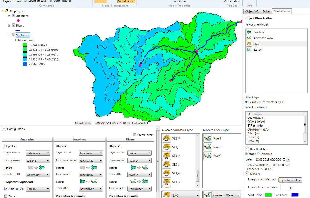
Modeling hydrological and hydraulic networks using a semi-distributed approach PRESENTATION RS MINERVE is a hydrological and hydraulic modeling software package that simulates rainfall-runoff transformations and free-surface flows. The software is capable of representing not only the main hydrological processes such as snowmelt, glacial melt and surface and subsurface flows, but also regulated structures such as reservoirs, gates, spillways, water intakes, turbines or pumps, and other hydraulic structures. Comprehensive analysis of a hydrological-hydraulic… Read More
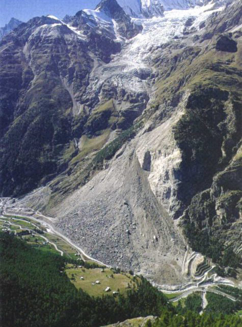
Water resources management (Peru)
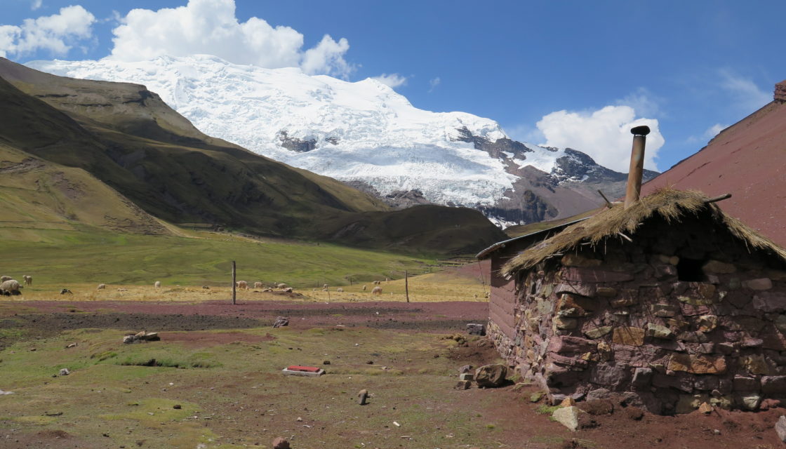
Glaciers + Project > Optimal management of water resources in mountain regions and in a context of climate change, Peru The multi-objective Glaciers+ project(Proyecto Glaciares+) was launched following the Glacier 513 project, which highlighted the potential of optimal water resource management in the Chucchún Valley. The aim of Glaciers+ was to reduce the risks associated with glacier retreat (flooding, block falls, etc.), and to optimize the management of water resources in mountain… Read More
Support for groundwater protection zones

Support for the SEN in the approval procedure for groundwater protection zones to guarantee the quality of our drinking water In the Valais, drinking water is almost entirely supplied by groundwater reserves. It is therefore essential to ensure the quality of the water we consume. In order to guarantee the long-term protection of the groundwater that feeds the public interest catchments (springs and wells) used to supply the population with drinking water,… Read More
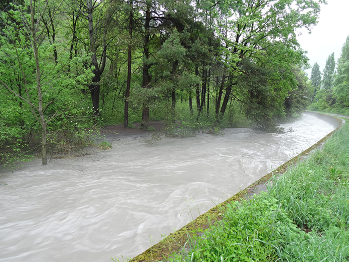
Operational flood forecasting system
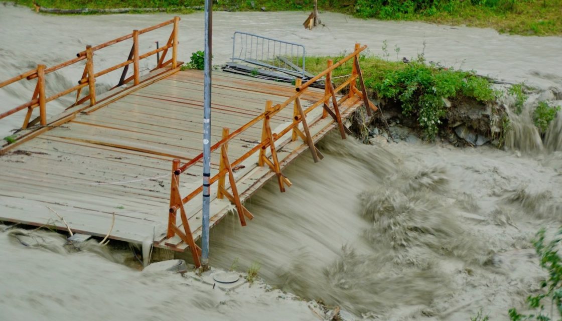
MINERVE: Operational flood forecasting and management system for the Canton of Valais Following the devastating flood of October 2000, the Canton of Valais entrusted CREALP with the development and implementation of a Rhône flood forecasting and management system: the MINERVE system (Modélisation des Intempéries de Nature Extrême du Rhône Valaisan et de leurs Effets). The system has been operational since 2013, and CREALP is responsible for its management and maintenance on behalf… Read More
Groundwater monitoring
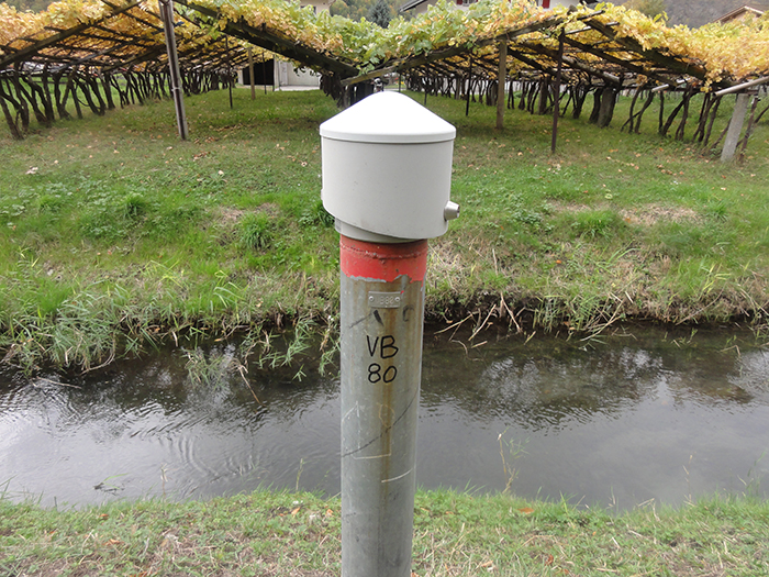
Monitoring groundwater in the Rhône plain and mountain aquifers In Switzerland, groundwater and springs cover more than 80% of water needs. With an annual production of over 1 millionm3, they are the main source of drinking and industrial water. Long-term monitoring of groundwater quality and groundwater levels is therefore of particular importance. This is all the more the case in Valais where, due to the specific nature of the recharge regime for… Read More
INTERREG Italy-Switzerland cooperation > RESERVAQUA project

Understanding water resources for better management Water resources in the Alps are under increasing pressure: shortages and deteriorating water quality are just some of the consequences of population growth, the impact of various human activities and climate change. The project is supported by the European Regional Development Fund through the INTERREG V-A Italy-Switzerland cooperation program and the Canton of Valais. Its aim is to assess the factors conditioning the distribution of resources… Read More
Spatial Reference Information System | Geological Hazards
A Spatially Referenced Information System for managing geological hazards in the canton of Valais SIRS-DAGEO is one of the spatially referenced information systems (SIRS) set up by the canton of Valais to optimize the use and development of information contained in natural hazard studies (avalanches, floods, ground instabilities). SIRS-DAGEO records information relating to geological hazards. Launched by the canton of Valais in 2004, SIRS-DAGEO enables data from geological hazard studies to be… Read More
Thermal balance of the water table
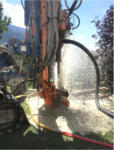
Inventory of groundwater use for heating and cooling in Sion, implementation of a temperature monitoring network. Groundwater is an important energy resource. It can be used to generate heat and cooling throughout the year. The groundwater table in the Rhône plain is often the focus of particular attention from planners, due to its high exploitation potential and proximity to the surface. There are around 150 installations in operation in the Sion area…. Read More