
DEEP CITY Verbier
Understanding water resources for better management
CREALP is involved in applying the Deep City method (Parriaux et al. 2010) to the Verbier region on behalf of the Val de Bagnes municipality. This method was developed based on the observation that, on a commune scale, underground space is limited and a source of both conflicts (of use) and synergies (geomaterials). This approach aims to popularize and map complex geological complexes in order to help towns and cities i) identify and protect the potential of underground natural resources and ii) anticipate their extension underground by defining the possible interactions between different underground uses.
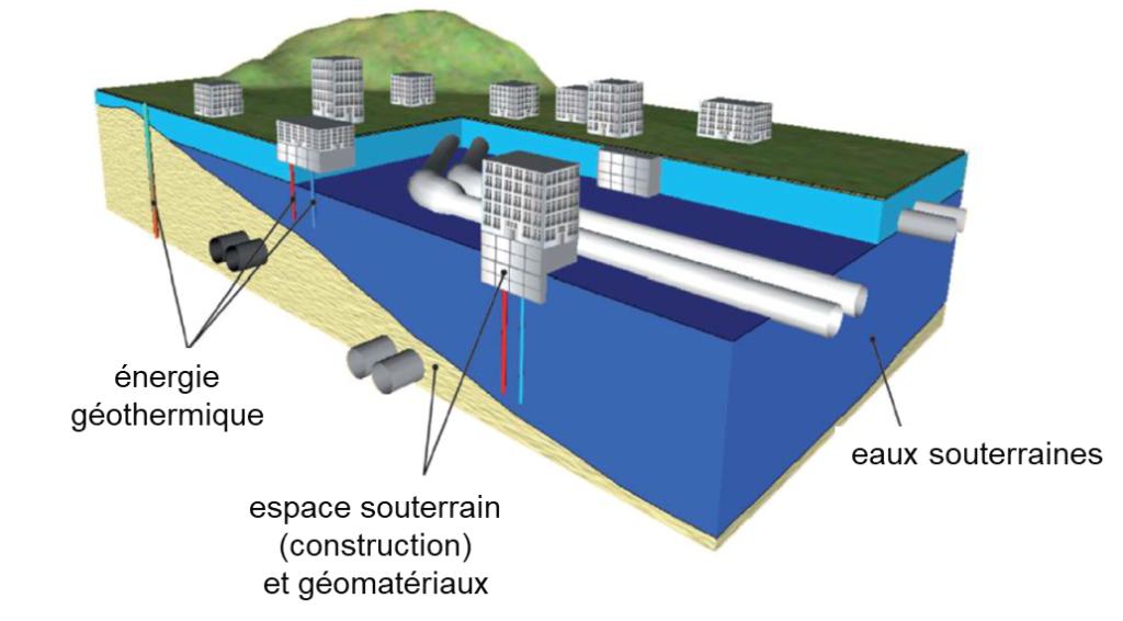
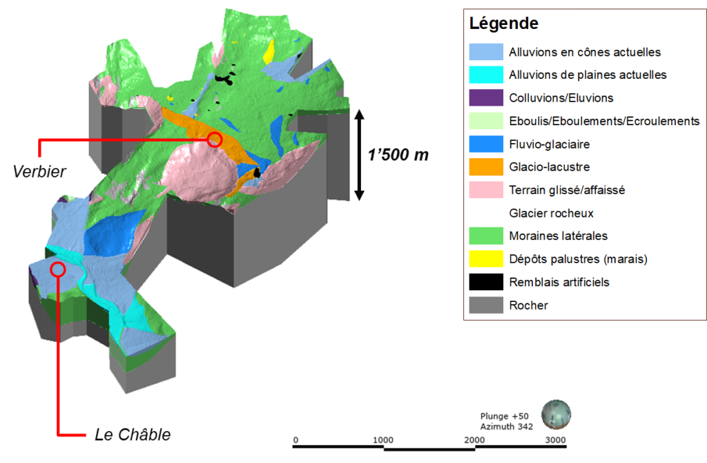
CREALP is responsible for compiling and integrating geological and hydrogeological information into a spatial database (mainly derived from borehole surveys). These processes involve various stages of interpretation, generalization, extrapolation and even simplification of geological complexity. Based on this data, a 3D geological model is created, enabling the production of various deliverables (maps, cross-sections, etc.) that can be used to make decisions on the project’s area of interest.
Information
Project manager: Ivann Milenkovic
Project duration: 2019 – 2021
Project sponsor: Commune of Val de Bagnes
Further information

Parriaux, A., Blunier, P., Maire, P., Dekkil, G., & Tacher, L. (2010). Projet Deep City: Ressources du sous-sol et développement durable des espaces urbains. vdf Hochschulverlag AG.
“On va vers le beau – RADIO.” Play RTS, Nov. 2, 2021, https://www.rts.ch/play/radio/emission/on-va-vers-le-beau?id=11536240.